NIPIGON -- Heading North of Nipigon along Hwy 11, on the right, there’s a sign for the Palisades trail. Blink and you’ll miss it! The road is quite bumpy but there’s plenty of parking at the base of the trail. It seems remote and unknown, we didn’t see anyone else on our hike.
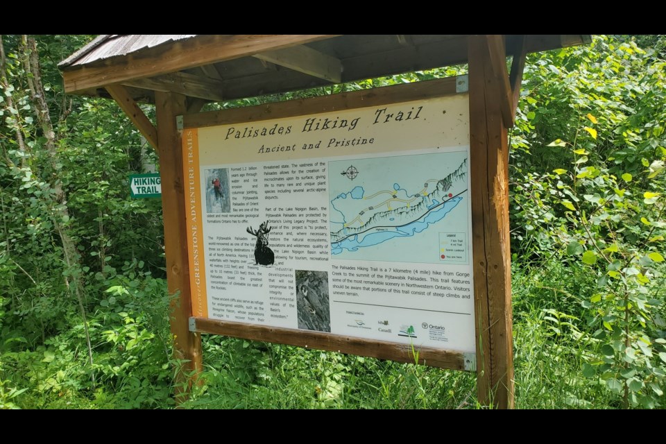
A sign for the Palisades trail marks the start of path, it’s a bit misleading as the two-dimensional map doesn’t really show the incline involved, although it does warn it is difficult and there is some climbing involved. The sign explains the Palisades were ‘formed 1.2 billion years ago through water and ice erosion’. It is a seven kilometre hike from Gorge Creek to the summit of the Palisades. Although it feels much farther given the steep incline and precarious footing for some parts of the hike.
The first part of the Palisades trail is surprisingly vertical. Two sets of stairs make this a much easier endeavour, although other parts are left to be climbed on your own. There are a lot of loose rocks and root growth to watch out for. This is a very popular area for ice climbing in the winter and apparently boasts the best ice climbing in Canada east of the rockies. If I had known this, I would have worn shoes with better grip.
The scenery on this hike is gorgeous - the sign at the beginning did not lie. Lots of local plant life, Blueberries were especially prevalent on this hike, and made a delicious snack along the way. We spotted Falcons at the first lookout - very close to a sheer cliff. Overlooking the vast green valley and the highway and homesteads below. Hummingbirds fluttered beside us along the way, probably also enjoying the wild flowers and berries along the path.
Some parts of this trail are less maintained, there are boardwalks over small crevices or streams that have fallen into disrepair and are a little scary to negotiate across. I would not recommend this trail for kids or pets as there are parts very close to cliffs with no barriers and the broken walkways are precarious in places.
After making it to the third lookout we decide to turn back, we passed several signs along the way, but we’re not sure how much further it is to the waterfall at the end of this trail, so we decided to turn back before the sun gets any lower in the sky. It would be helpful if the trail markers indicated the distance travelled to that point, so we would have known how much further to the waterfall at the end of the trail.
Going up was difficult but going down was a little perilous in parts, it’s too bad this trail doesn’t loop around. We turn back the way we came. Loose rocks made going downhill difficult and painstaking at times. The stairs are in great shape and make going downhill much easier - they must have been very difficult to build!
Overall this is a beautiful trail with breathtaking views and an abundance of unique flora and fauna to investigate and research along the way. Be sure to bring plenty of water, bug repellant and snacks. A first aid kit may be a good idea too, just in case anyone trips or slips along the way. I was nervous on the way back down the trail most of all. It was my own fault for not wearing better hiking shoes for this trip. I will be better prepared next time.


