SUPERIOR NORTH -- Environment Canada has issued a severe thunderstorm watch in effect for parts of the region.
The government weather agency says A line of thunderstorms is expected to develop Thursday afternoon into this evening ahead of a cold front moving across northern Ontario.
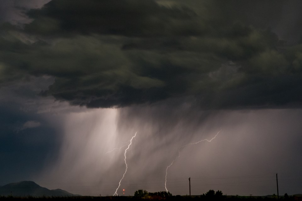
The main threats with these storms will be wind gusts up to 100 kilometres an hour and hail up to ping pong ball size. A tornado cannot be ruled out at this point.
Those in Gull Bay - Black Strugeon Lake should be on the lookout for adverse weather conditions as updated the area's watch to a warning.
Large hail can damage property and cause injury. Very strong wind gusts can damage buildings, down trees and blow large vehicles off the road. Lightning kills and injures Canadians every year. Remember, when thunder roars, go indoors.
Severe thunderstorm watches are issued when atmospheric conditions are favourable for the development of thunderstorms that could produce one or more of the following: large hail, damaging winds, torrential rainfall.
Severe thunderstorm watch in effect for:
- Geraldton - Longlac - Caramat
- Manitouwadge - Hornepayne
- Nakina - Aroland - Pagwa
- Fort Hope - Lansdowne House - Ogoki
- Armstrong - Auden - Wabakimi Park
- Beardmore - Jellicoe - Macdiarmid
- Gull Bay - Black Sturgeon Lake
